Alpine Mountain (3D)
- Houdini 22
- Solaris
- Karma
- VEX
- MaterialX
- HouLab (own tools)
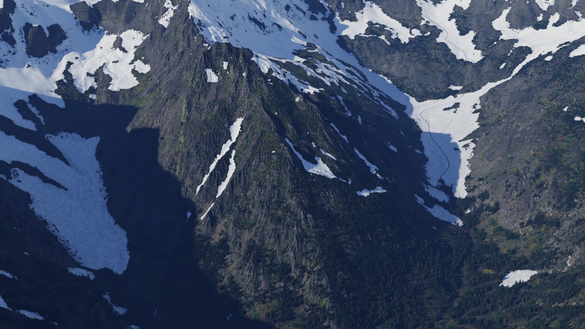
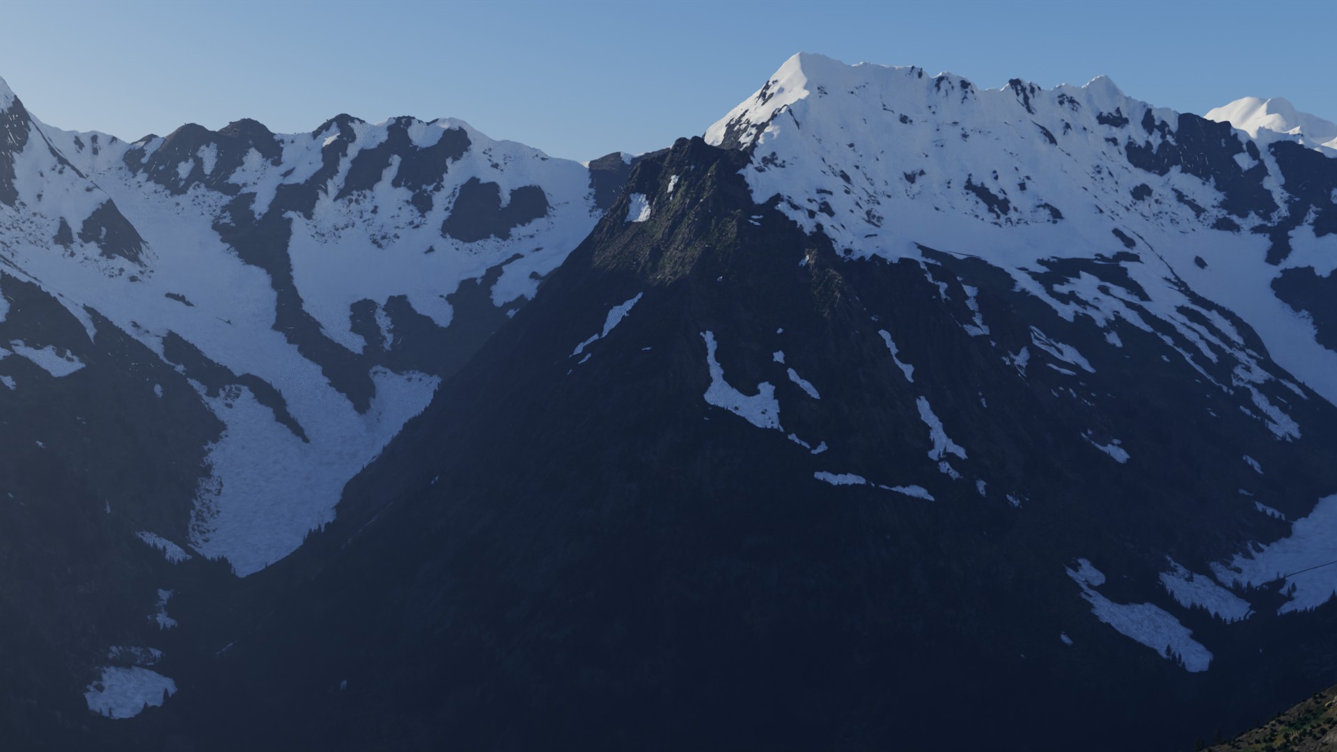
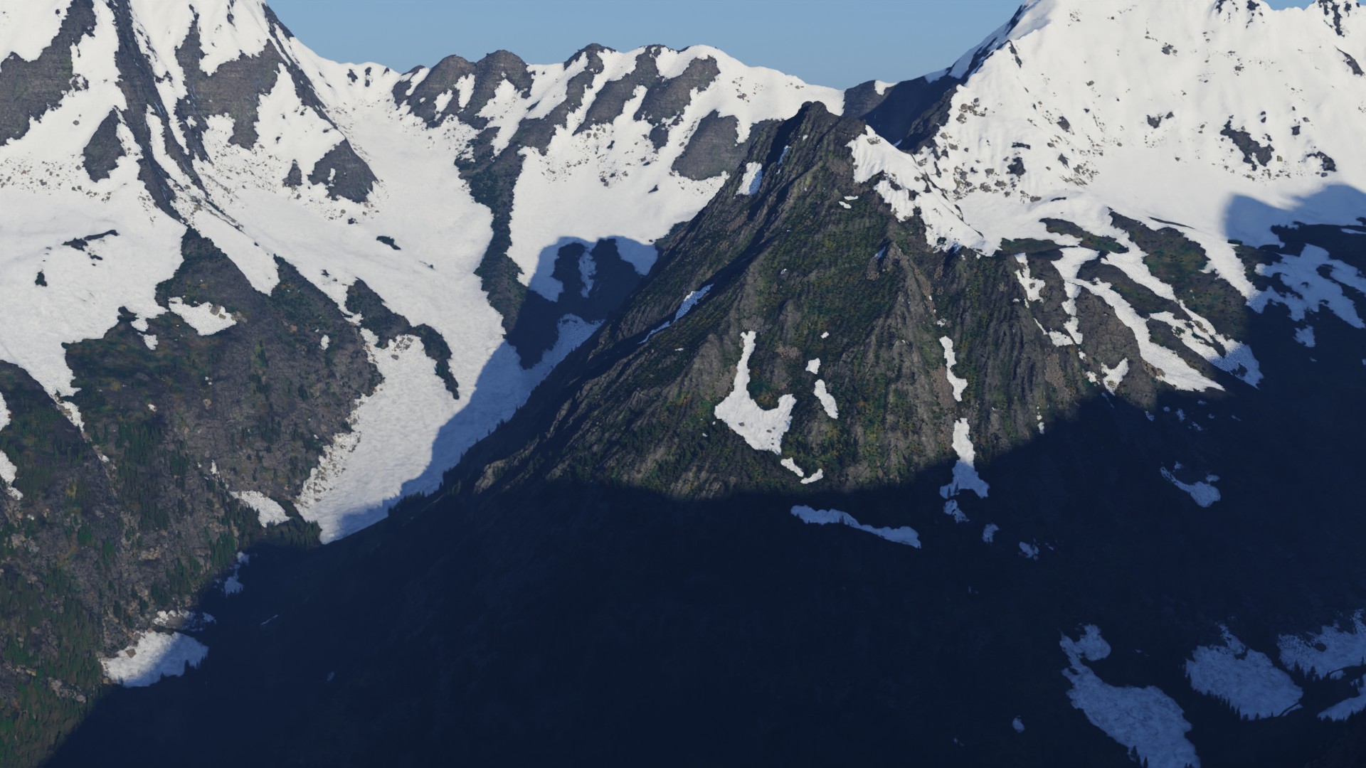
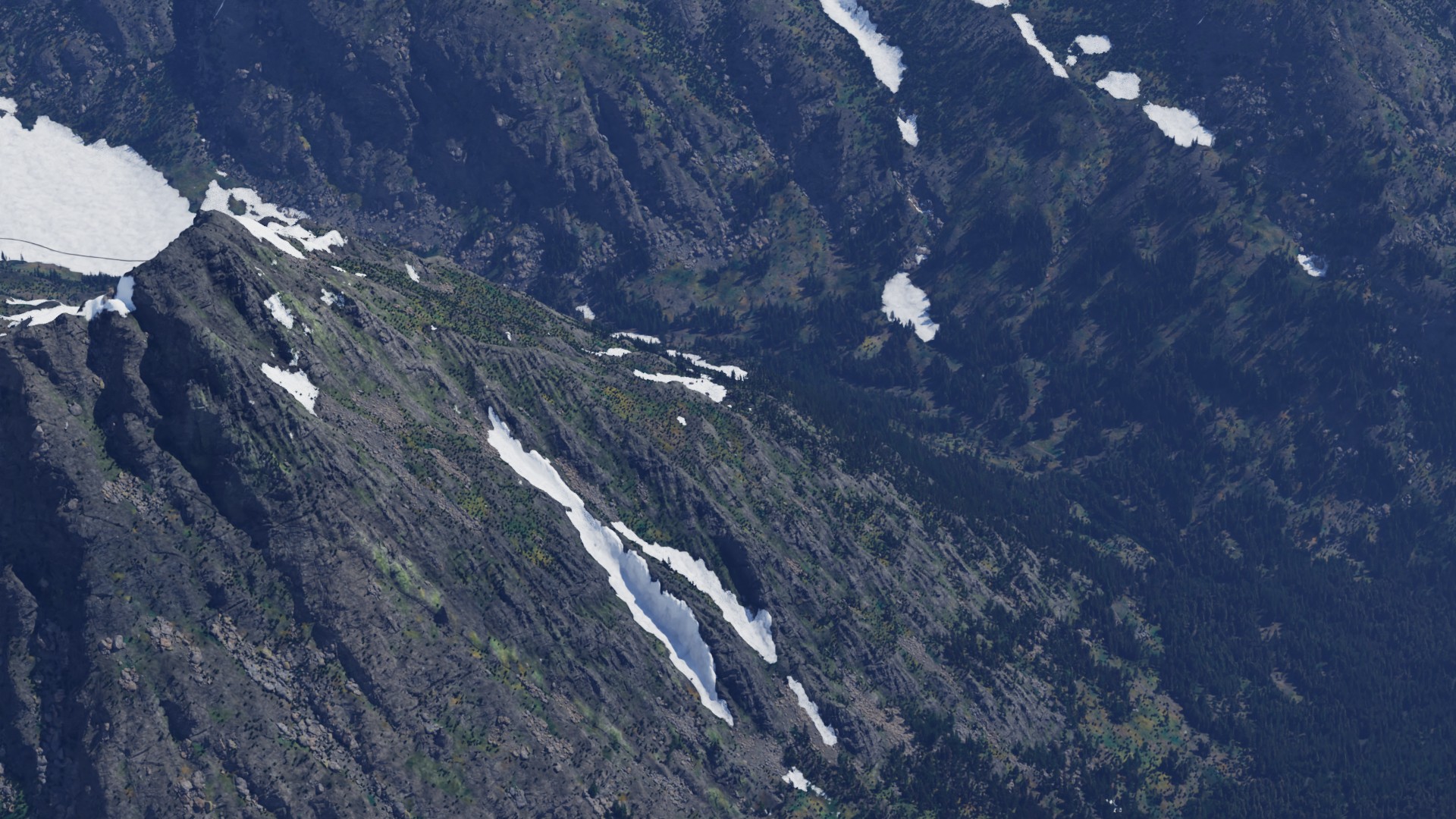
A real Swiss mountain, from survey data to final frames. A one-kilometre hero tile built from the national elevation survey carries the full ecosystem: meadows, dwarf pine, scree and snow. Around it, 10 km of real terrain runs to the horizon. Every fix along the way was measured first, then made.
Terrain
Choosing the mountain
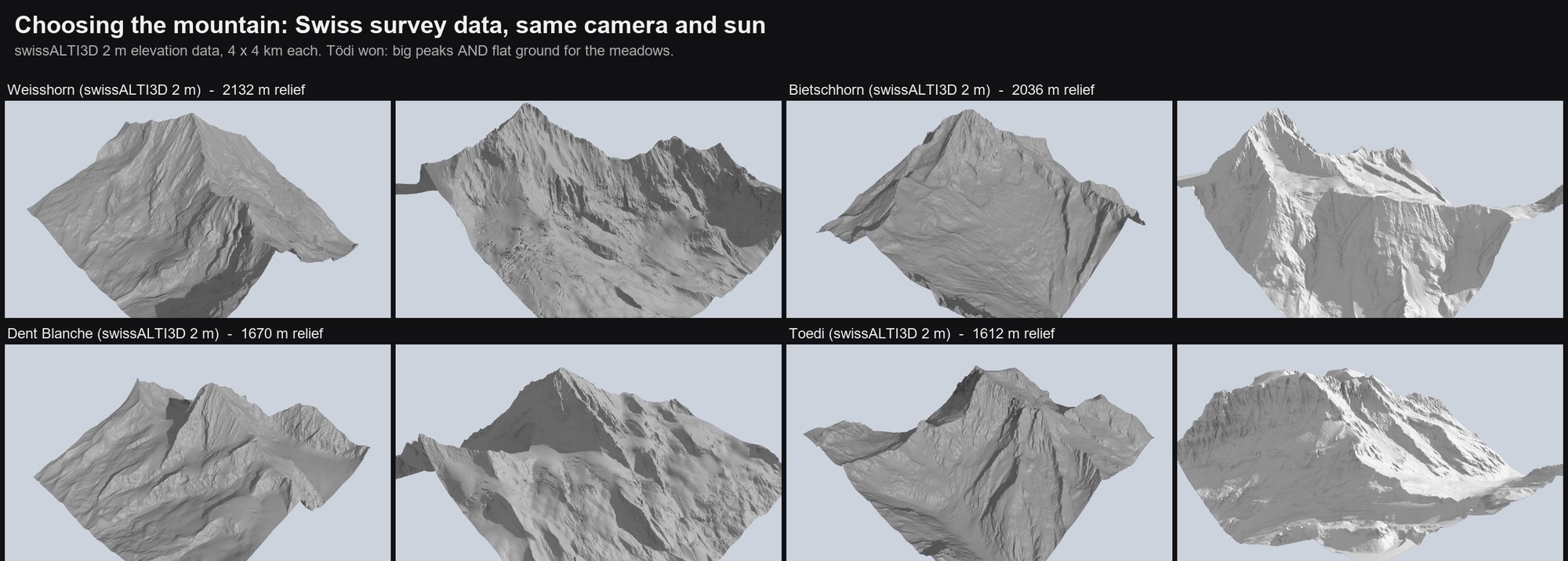
I wanted big peaks and flat ground, because the meadow system needs somewhere to grow. I rendered eight candidates from swissALTI3D, the Swiss 2 m elevation data, with the same camera and sun. The Eiger and the Weisshorn are all wall. The Tödi has a summit, cliffs, and broad valley floors.
Ecology
Reading the terrain
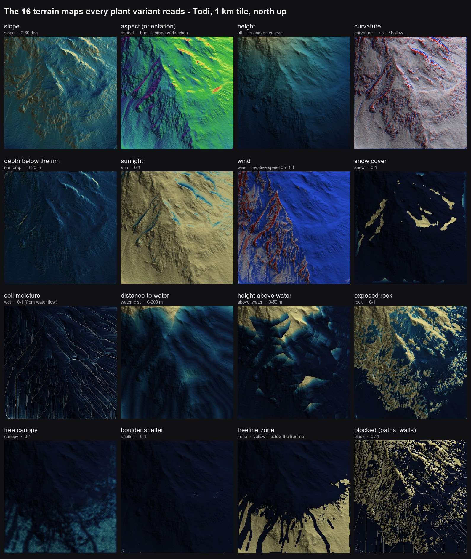
The ecosystem reads the mountain the way an ecologist reads a hillside. Before any plant is placed, the tile becomes 16 maps in real-world units: slope, orientation, height, curvature, depth below a rim, sunlight, winter wind, snow, soil moisture, distance to and height above water, exposed rock, tree canopy, boulder shelter, the treeline, and blocked ground. Every plant community reads only these, so the same research-based variants that grew the earlier meadow grow on the Tödi without changes.
Ecology
Who grows where
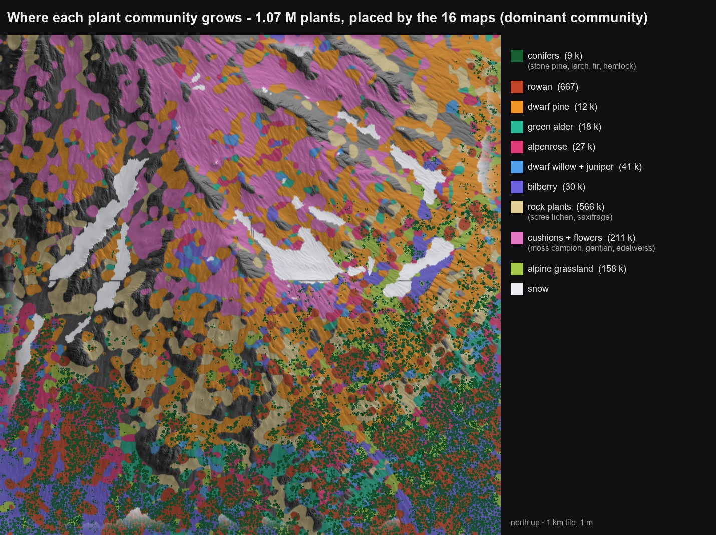
Placement runs on the 16 maps alone. On the Tödi tile, 1.07 million plants of 17 species settle into communities the way they would on a real Alpine slope: cushion plants and flowers on the upper slopes, dwarf pine across the steep middle ground, rock plants on the scree fans, and below the treeline a forest of stone pine, larch and fir with grassland, alpenrose and bilberry in the gaps.
Backdrop
A hero tile inside 10 km of real land
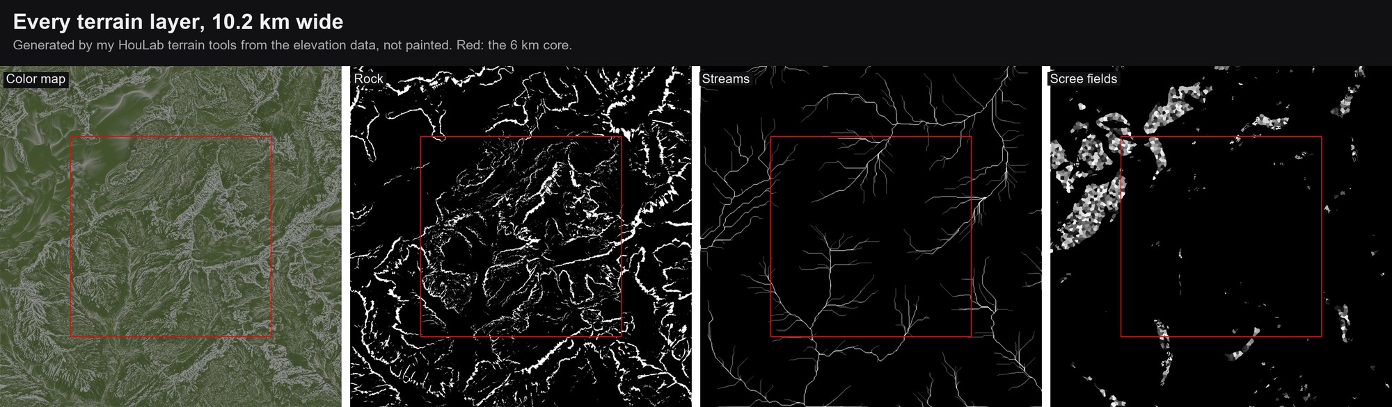
The hero tile is 1 km at 1 m resolution. The backdrop is the same survey data at 2 m and 10 m, fetched as a 6 km core plus a 3 km ring, so the land past the core is real too.
None of these maps are painted. My HouLab terrain tools generate every one of them from the elevation data alone: the colour map and its masks from the shape of the land (about 7 minutes on the GPU for 10.2 km at 2 m), the rock and scree fields from where debris breaks off and settles, and the streams and valley lines from water flowing over the terrain. Point the tools at a different mountain and the whole set regenerates.
Terrain
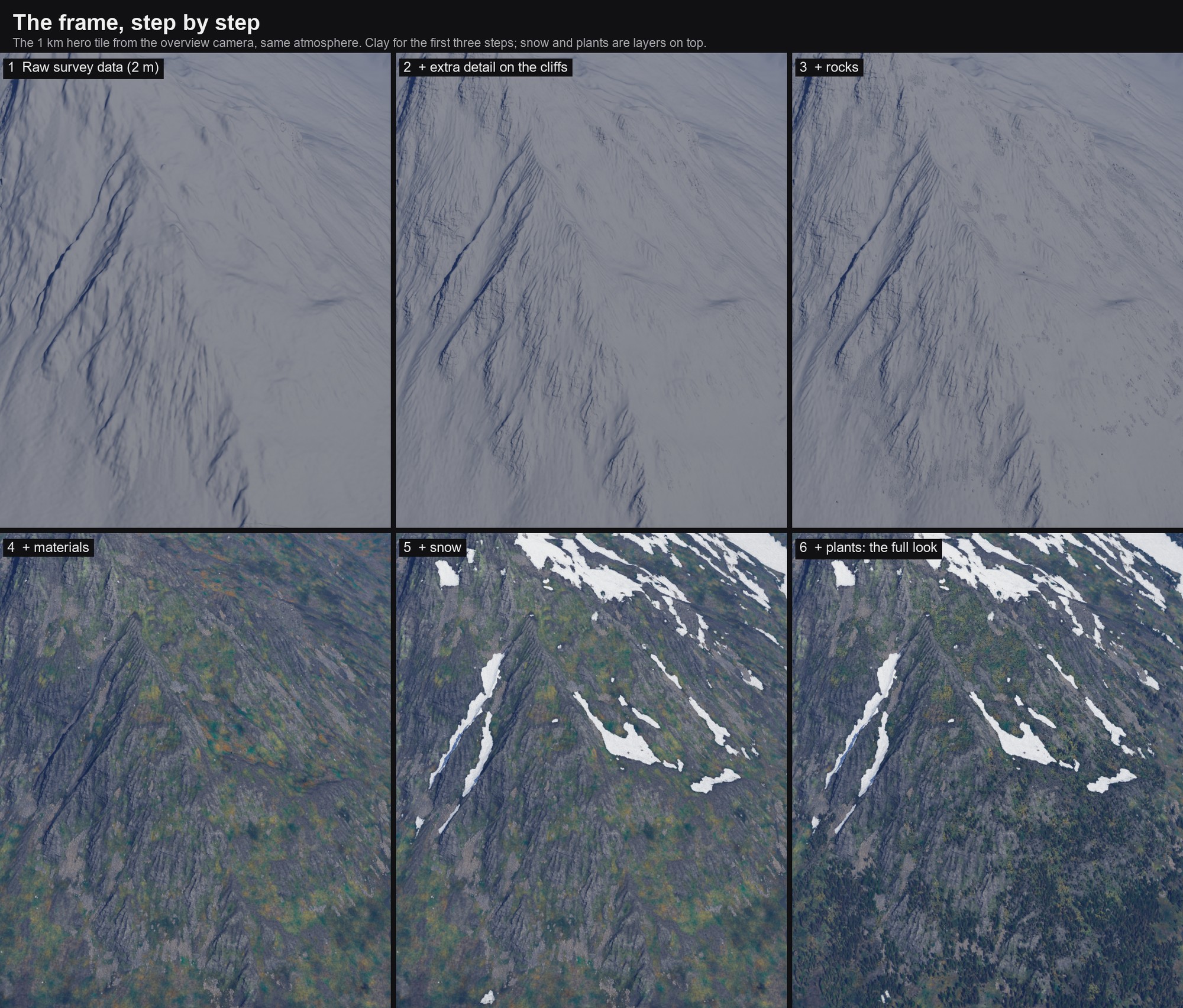
The frame, step by step
The hero tile starts as the raw survey data and gains one layer at a time, each one a debug look of the same scene and camera. The tools add detail where the 2 m data is too soft: the steep sides are remeshed and displaced into ledges and blocks. Rocks come next, then the ground materials. Snow goes on as its own layer over a complete mountain, and the plants last.
Snow
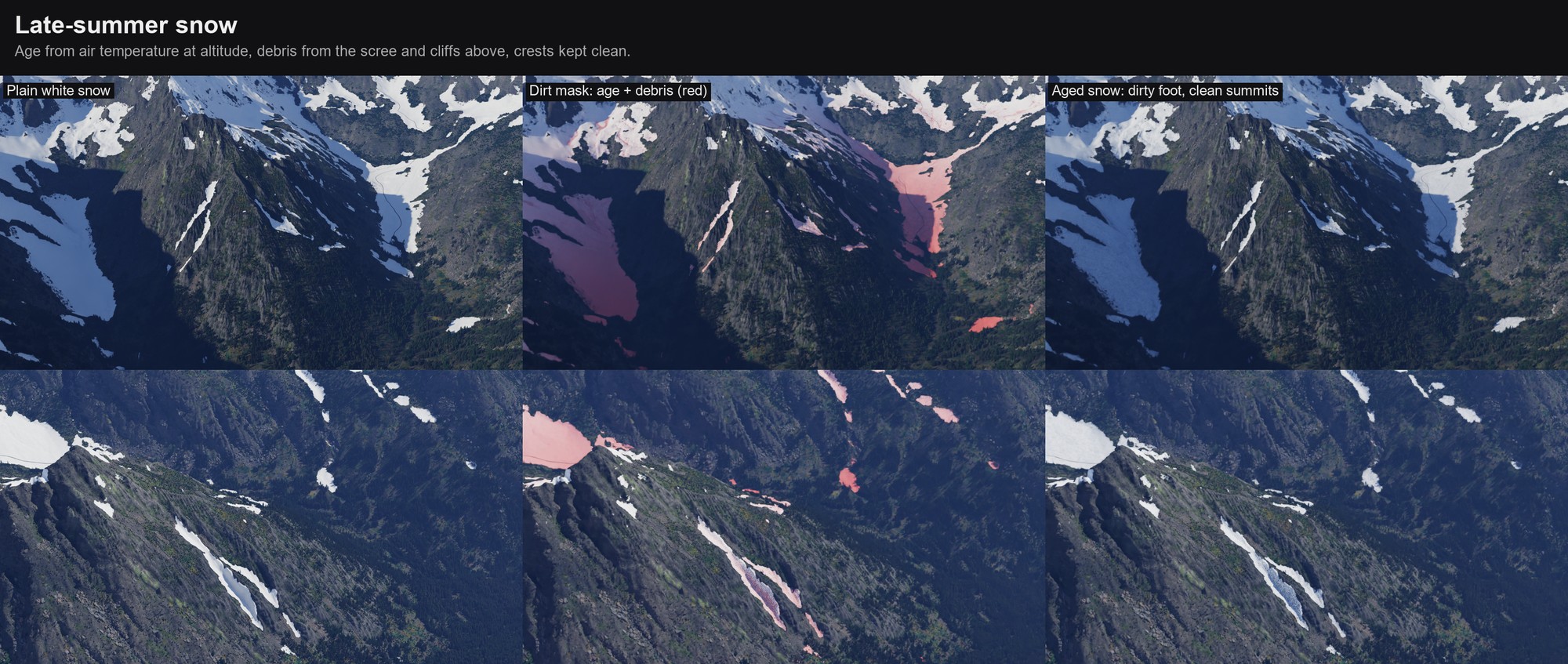
Late-summer snow
Late-summer snow is old snow, and old snow is dirty, but not evenly. Each patch gets a dirt mask from two physical causes. Age: snow darkens with warm days since the last snowfall, so the shader works out the air temperature at each point from its altitude (6.5 °C per km) and ages the snow below about 2.9 km. Debris: rockfall and dirty avalanches end at the foot of slopes, so snow below scree and cliffs collects dirt, while wind-scoured crests stay clean. Where the mask is dirty, albedo drops from about 0.72 to 0.49, the measured range from fresh to old snow, and melt runnels and debris trails run down the fall line on slopes steeper than about 14°. A ring of wet, bare ground marks where each patch has just melted back. The numbers come from published snow and glacier albedo studies.
Camera
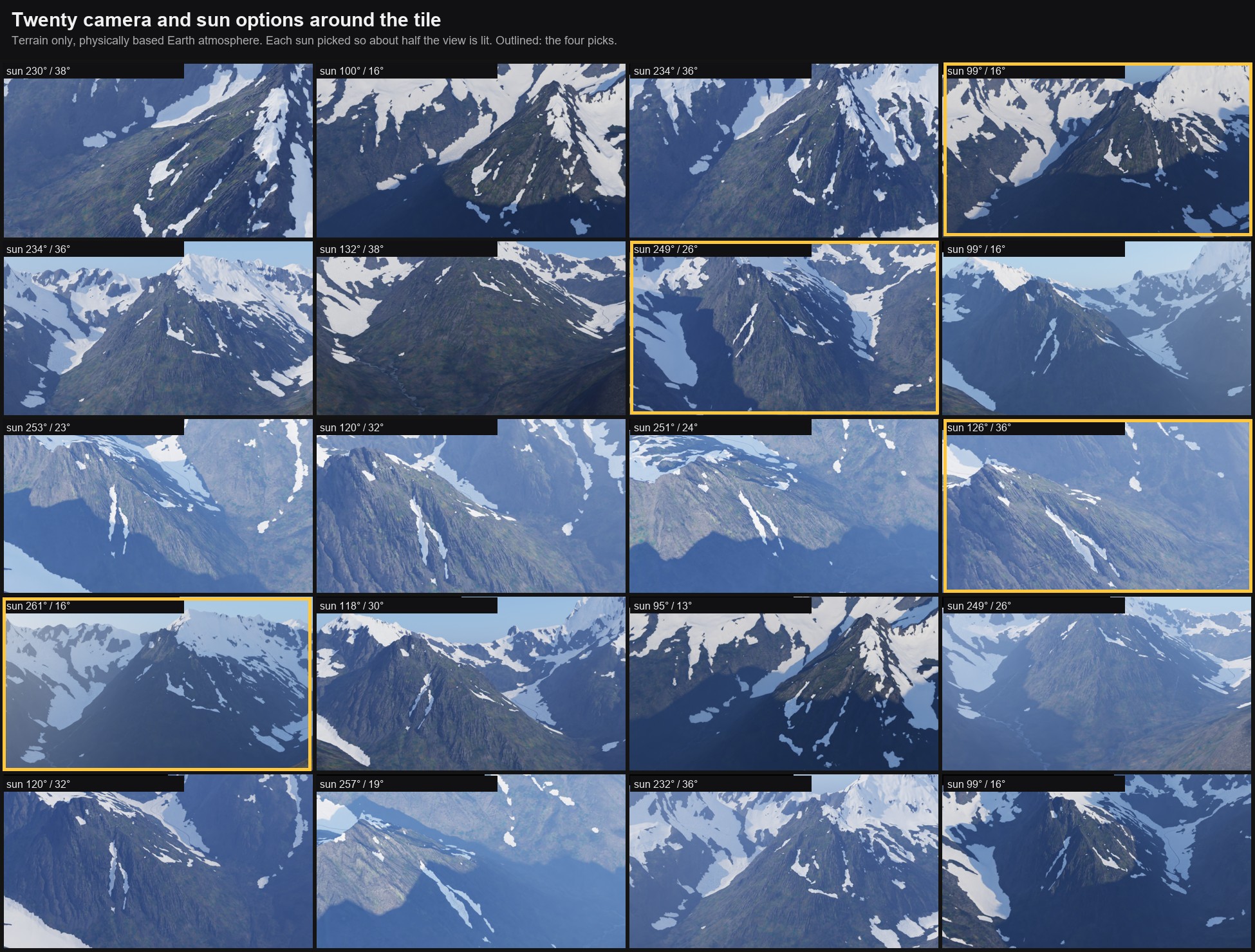
Finding the shots
Before rendering anything heavy, I rendered twenty camera and sun options around the tile, terrain only, under my own physically based atmosphere tool on its Earth preset. Each sun was chosen by casting shadow rays, so about half of each view is lit; a sun at 90° to the view left some options only 3 % lit. The haze is research-based too: the default aerosol was sea-level air, about 245 km of visibility. The finals use about 87 km.
Rendered in Karma CPU. The ecosystem, terrain and atmosphere tools are my own HouLab toolset, Planet Atmosphere HDA included. Data: swissALTI3D by swisstopo, the Swiss Federal Office of Topography. Rock scans: Megascans.